


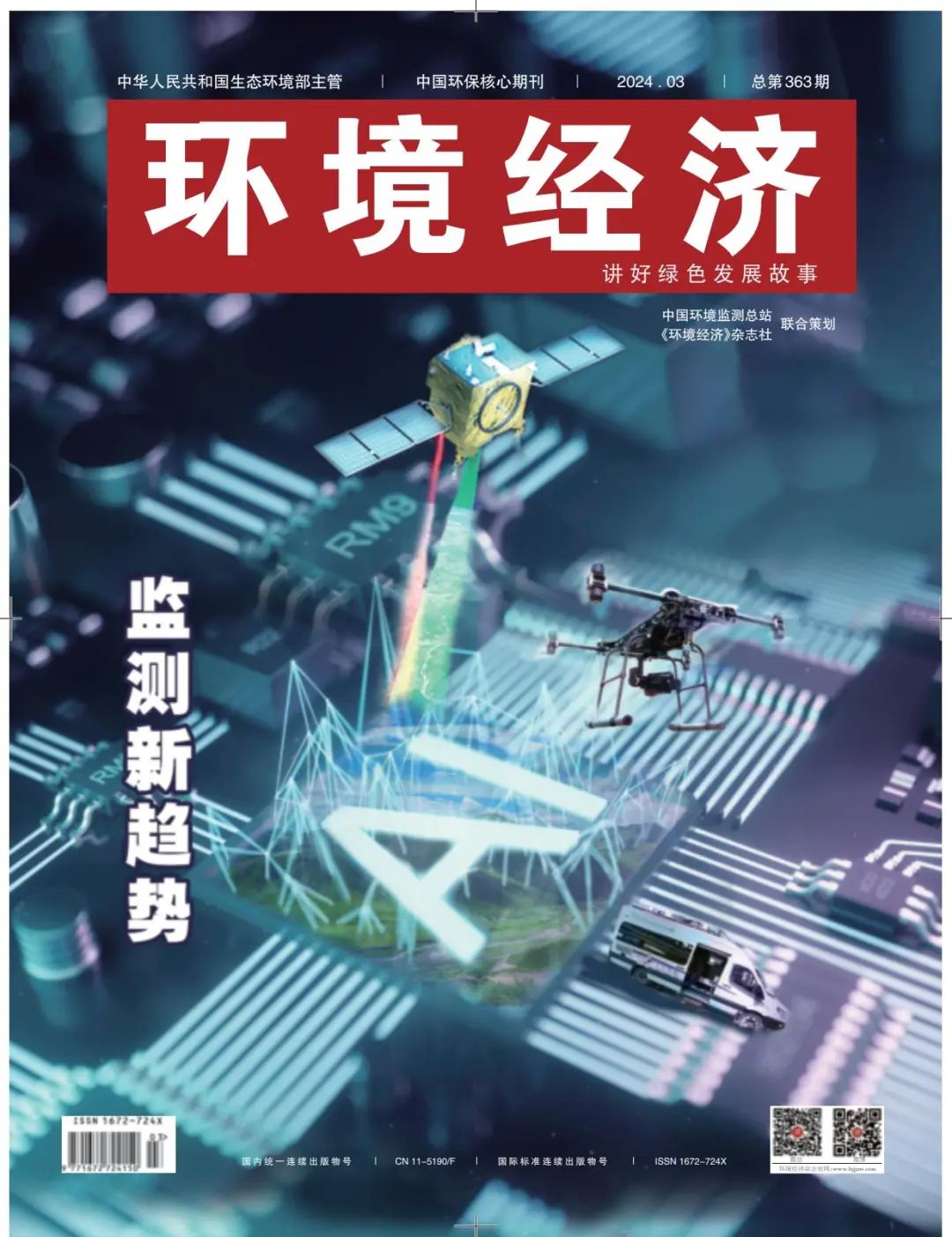
Monitoring "black technology" covers "water, land and air"
The introduction of black technology has brought profound and tremendous changes to the field of ecological environment monitoring. Through advanced artificial intelligence, big data analysis and high-precision sensor technology, the accuracy, real-time and intelligence level of environmental monitoring has been significantly improved. With the help of innovative scientific and technological means, ecological environment monitoring has gradually entered a more intelligent, scientific and accurate era.
Environmental optics: a powerful tool for air pollution monitoring
"Ecological environment monitoring technology and equipment is the source of the development of environmental science and technology in the information age, the 'forerunner' of ecological and environmental science, and the 'multiplier' of China's green and low-carbon development. Liu Wenqing, academician of the Chinese Academy of Engineering and academic director of the Anhui Institute of Optics and Fine Mechanics of the Chinese Academy of Sciences, said that the environmental high-tech system is the foundation for China's green and low-carbon development, and the development of intelligent monitoring technology is also a huge driving force for low-carbon development.
As a leader in the field of environmental optical monitoring in China, Liu Wenqing shared the progress and application of environmental optical monitoring technology.
The transmission and transformation process of air pollution is not only on the ground, but also mainly at high altitudes, and it may not be solved by ground monitoring alone in order to study air pollutants in depth. Liu Wenqing introduced that by using the scattered light from the sky and using a certain algorithm, it is possible to obtain the degree of harm of particulate matter and trace gases staying at high altitudes. Through long-term monitoring, we can know the transport characteristics of mutual pollution between two cities, so as to solve the problem of the accuracy of satellite platforms under the background of high pollution in China.
"The second major application of optical monitoring technology in the environmental field is radar detection, and radar technology for the atmospheric environment is aerosol. Liu Wenqing said that aerosol flux detection lidar can identify the spatial and temporal distribution characteristics of air pollutants and explore the spatial and temporal transmission characteristics. The radar data was fitted with ground station data and meteorological observation data by machine learning, and PM10/PM2.5 was calculated by particle size. It can also measure the impact of external transportation/local emissions in real time, and guide the cascading prevention and control of cities.
Despite the positive results in the field of ambient optical monitoring, dependence on the development and manufacturing of high-end instruments remains. From the perspective of key technologies for monitoring and supervision, in terms of high-end instruments and equipment, "stuck neck" technology accounts for 70%. "Some large foreign enterprises build factories in China, research and development abroad, and only sell things, not technology. Liu Wenqing explained, "In this regard, we have investigated the aspects that should be strengthened in the monitoring of pollution sources and smart monitoring, and strive to break through this situation during the 14th Five-Year Plan period." ”
Liu Wenqing said that in recent years, the reason for the progress of air pollution control is to pay attention to the progress of monitoring technology, and in the future, it is necessary to increase efforts to promote the development of atmospheric environment monitoring technology and the research and development of instruments and equipment, and at the same time pay attention to the combination of various technologies and the integration of monitoring data, and properly deal with the current environmental problems.
Satellite remote sensing monitoring: space-ground integration
In the field of remote sensing monitoring of water ecology in the basin, through remote sensing technology, we can remotely obtain the key information of the water body in the basin, and realize real-time monitoring of multi-dimensional data such as water quality, water temperature, and water level.
Wang Qiao, an academician of the Chinese Academy of Engineering, said that in recent years, China has gradually established a space-ground integrated ecological environment remote sensing monitoring business system from scratch, and has the ability to monitor water environment and ecosystem changes from satellite to ground, which has fully supported the solid progress of ecological environmental protection and governance.
At present, the water ecological problems in China are still relatively prominent, and the deep-seated problems such as water ecological imbalance, insufficient ecological water, reduced biodiversity, partial loss of aquatic habitat, degradation of water ecosystem structure and function, increased water ecological risk, and aggravation of non-point source pollution need to be solved urgently. Wang Qiao said frankly that because of this, the country urgently needs to develop efficient water ecological monitoring technology to comprehensively control the evolution trend of the water ecological environment in the basin and realize the transformation of water environment quality from category improvement to ecological health.
Wang Qiao said that the connotation of water ecological monitoring has been continuously expanded, and has developed from a single physical and chemical index to include comprehensive elements of water ecology such as water quality, hydrology, biology, and habitat, as well as many specific pollution. At present, it is mainly based on ground monitoring, including manual investigation. "These methods have very obvious advantages, but they also have problems and limitations that need to be addressed, including spatial representation, continuity, etc. ”
"The remote sensing monitoring of water ecology in the basin mainly uses satellite remote sensing technology, which has obvious advantages, large-scale synchronization and spatial continuity...... It should be said that such a technology can carry out all-round and efficient monitoring of water ecology in the basin. Wang Qiao introduced that the remote sensing monitoring of water ecology in the basin can timely discover water ecological problems, accurately grasp water ecological changes, objectively reflect the effectiveness of water ecology, comprehensively evaluate the quality of water ecology, and efficiently serve water ecological management. Therefore, under the new situation, the remote sensing technology of water ecology in the basin can provide new support for the decision-making of water ecology management in the basin and take on a new mission.
In recent years, great progress has been made in the remote sensing monitoring of water ecology in river basins in China, but there are still many challenges. Wang Qiao said that the more prominent problem now is the sudden water ecological risk in the river basin. "Because the occurrence of risk is random, abrupt, accidental, hidden, and often 'chained', one thing happens, and it may be followed by a series of things. How to detect such sudden aquatic ecological anomalies? This is one of the major problems we are facing. Wang Qiao said.
In this regard, Wang Qiao gave an example, "For example, in the 2023 Gansu earthquake, due to various technical limitations, it is difficult for us to use remote sensing to completely restore the sudden events, not only the water ecology of the basin, but also the entire remote sensing monitoring industry is facing this problem, that is, how to expand the lagging and inefficient remote sensing monitoring of the ecological environment to real-time and intelligent remote sensing monitoring of the ecological environment." ”
In addition to the monitoring of the water ecological environment, satellite remote sensing technology has also been applied to the monitoring of the atmospheric environment, and Zou Bin, a professor at Central South University, put forward the thinking of remote sensing big data empowering the precise prevention and control of urban air pollution with the pilot case of Changsha, Hunan.
Earlier, the hotspot grid of atmospheric monitoring applied in Changsha was 3km×3km, and the hotspot grid was sent once every ten days on the platform, but due to the large space and long time, it was difficult to accurately trace the source. Through effective modeling and data foundation, Changsha has reduced the grid of atmospheric monitoring hotspots to 100m ×100m to facilitate better traceability. At the same time, a simple platform was built to include a grid of 100 meters per hour every day. With the help of this set of models, Changsha has successfully achieved a more accurate capture of doubts and tackling key problems.

Water Quality Fingerprint Technology: The "Sherlock Holmes" of Water Environment Governance
"I have a lot of contact with companies, and I find that many companies are not easy to do water treatment, and they use a lot of tricks to cope with the inspection. For example, repairing accident pools to store up sewage and discharging it at the 'right' time. As the pioneer of water quality fingerprint pollution traceability technology (hereinafter referred to as water quality fingerprint), Wu Jing, director of the Environmental Pollution Traceability and Fine Supervision Technology Research Center of the School of Environment of Tsinghua University, shared the development process of this technology.
"I found that the local ecology and environment department was very hard, and ran to take samples at 3 o'clock in the morning to see if the company was secretly discharged. At that time, I thought, if there is something like an 'ID card', can it be accurately managed? Referring to the original idea of water quality fingerprinting, Wu Jing said.
Water quality fingerprint is a water environment supervision technology, known as the "Sherlock Holmes" of water environment governance, which innovatively introduces the idea of using fingerprints to find "criminal suspects" in criminal investigation into water environment supervision, breaking through the technical bottleneck of difficult and slow traceability in the field of water pollution prevention and control.
So, what problems can the water quality fingerprint solve? The most important thing is the problem of pollution control. Wu Jing introduced that for water environmental pollution, if we can find the source and carry out source treatment, we will soon see the effect.
Specifically, different water samples have different water quality fingerprints. The wastewater discharged from each pollution source has its own unique three-dimensional fluorescence spectrum, which can be used as its water quality fingerprint. The higher the pollution concentration, the higher the intensity of the water quality fingerprint peak. By comparing the water quality fingerprint to be tested with the water quality fingerprint database of known pollution sources, the pollution "suspect" can be quickly found.
Wu Jing introduced that they have taken the lead in inventing a series of traceability instruments, and the traceability time is 21 minutes, which can accurately determine the specific pollution source. In addition, it is recommended to establish a full-chain regional water environment security guarantee system, including placing traceability instruments in the perception layer, water bodies at water sources, important sections, sewage pipe networks and rainwater pipe networks, and supporting regional water pollution early warning and traceability systems at the application layer.
It is understood that this system can accurately complete the last 1 km of traceability, identify the key polluted river sections and main pollution sources in the region, find the focus of governance and management and the main body of responsibility, and promote the realization of source governance. In addition, it can promote an efficient early warning-traceability-law enforcement/emergency linkage mechanism, improve the level of water environment supervision and emergency response, and maintain the effect of water environment governance for a long time.
"We have seen a clear deterrent effect of water quality fingerprints in many places. Wu Jing used a case to explain. In 2017, water quality fingerprint traceability technology was implemented in an electroplating industrial park in the south, and at that time, enterprises with excessive emissions and illegal emissions in the park were found through technology. Subsequently, the local regulatory authorities punished these companies and carried out a lot of publicity and reporting, and the local enterprises also knew about the incident. In the follow-up water quality monitoring, it was found that the characteristic pollutants of the wastewater discharged from the park showed a downward trend of oscillation, and remained stable at a low level after 2019. "Why does the shock drop happen? because I am afraid of being caught!" This reflects that the water quality fingerprint has a strong deterrent effect on enterprises.
AI technology: Make monitoring data analysis smarter
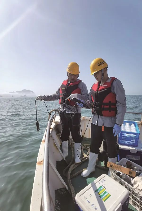
Monitors carry out maritime surveillance. Bu Xuelin/photo
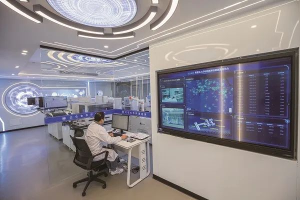
Big data smart monitoring is becoming a leader in the field of environmental monitoring, providing us with more comprehensive and real-time environmental data, as well as more intelligent monitoring and analysis methods. In this digital era, the application of big data technology is driving environmental monitoring forward, providing more accurate and efficient decision-making support for environmental monitoring.
"A very important direction for the modernization of environmental monitoring is intelligence, digitalization and intelligence. He Weiqi, deputy chief engineer of Tsinghua Suzhou Environmental Innovation Research Institute and director of the Environmental Big Data Science Center, said that the integrated monitoring system of "sky, ground and sea" is constantly improving, and many places are using multi-element and high-density monitoring methods when building a smart monitoring system. So, we may want to think about whether this kind of multi-element high-density monitoring is equivalent to smart monitoring?
He Weiqi said that data becomes information and then becomes wisdom, which requires processing and data processing. In this process, a lot of artificial intelligence technology is actually needed.
He Weiqi further explained that the first aspect is to integrate some structured data and unstructured data into data that can be interconnected and can be analyzed and used together. The second aspect is to provide a series of data mining methods, models and tools to help us analyze the value of data from massive data.
He Weiqi believes that big data will help us improve our prediction capabilities in subsequent environmental monitoring work. In this regard, He Weiqi took carbon emission monitoring as an example to explain.
"Through the introduction of big data model algorithms, we have now released a real-time monitoring platform for global carbon emissions, which can realize the data display of hourly steps. It includes data from the global power production sector, urban traffic congestion index data, as well as global human data and land surface temperature data. ”
For the application of artificial intelligence (AI) technology in environmental pollution cases, Sun Mingsheng, a researcher at the Institute of Atmospheric Physics of the Chinese Academy of Sciences, introduced the pollution case of AI weather typing as an example. Sun Mingsheng said that the use of traditional technology to build a case library, mainly relying on manual collation, archiving, classification and diagnosis of a historical meteorological field, air quality, pollution sources and other multi-source data, technical methods are scattered, the operation mode is single, the quality of the case library is generally not high, and the application effect is not good.
Specifically, the automatic recognition algorithm divides the weather situation into three categories, namely, line, surface and entity, each of which is broken to form a systematic artificial intelligence algorithm process; the three-dimensional construction algorithm is used to reconstruct the two-dimensional weather situation into three dimensions to completely reproduce the three-dimensional structure of the atmosphere; the corresponding artificial intelligence model is trained through the labels marked by meteorological experts, which can perfectly abstract the judgment experience of meteorological experts and judge the weather situation very objectively.
Efficiently and accurately extracting useful and comprehensive information from large amounts of information requires increasing computing power. The large model algorithm and high computing power behind artificial intelligence are aimed at improving the data information processing ability and can quickly extract usable information.
In the future, scientific and technological innovation will continue to empower the prevention and control of air pollution, and become a major help for the realization of governance goals.


